Bad Timing
Day 10
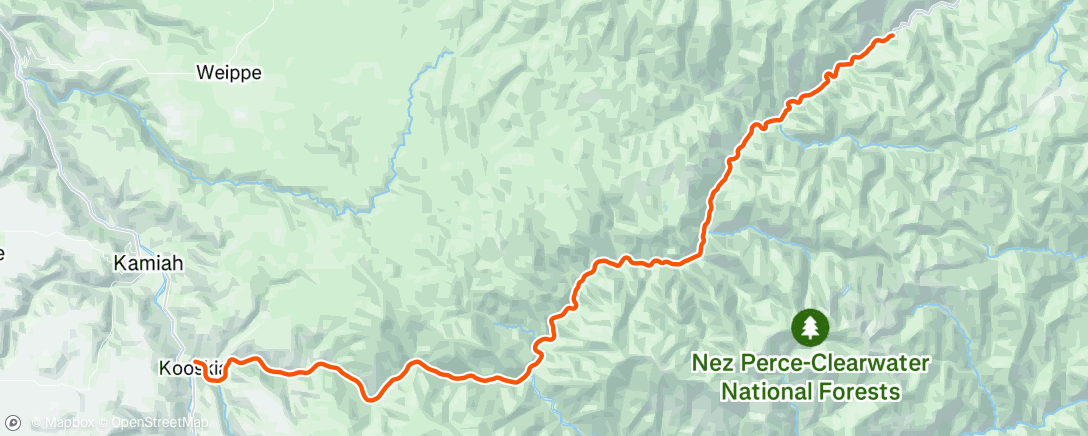
Today the route leaves Kooskia which is along the middle fork of the Clearwater River.

It climbs steadily for 100 miles to Lolo Pass and the Montana Border. Along the Clearwater river there were several of these cable crossings.

One was labeled a tree farm. Nowhere on the other side of the river did I see anything other than wild forest. The Middle Fork of the Clearwater river is formed when the Lochsa River joins with the Selwah River Other than the heat, the natural beauty of this road is hard to describe.

Given the current heat conditions, I have chosen to pull a hard stop if the temperature reaches 100 degrees Farenheit. Leslie arranged to meet me at about 50 miles for lunch, there are no towns or services on this road. When I rolled into lunch the temp had climbed to 97. After lunch, my bike computer read 106 in the parking lot. Not looking too promising. I set off, and watched the temp climb to 108. I had told Leslie to wait for me about 10 miles down the road. After 3 miles, I realized I should have asked her to wait 2 miles down the road. I came upon a couple of men who had given up fishing due to the heat, and offered me a ride to where she was waiting.
The road is a steady uphill, not steep, so there was no point to rest and cool off a bit as you roll downhill.
The numbers
Distance: 53
Avg Speed: 135
Total Climbing: 808 ft.
Morning Ride
Distance
59.06 mi
Elev Gain
807 ft
Time
4h 1m
Strava is slightly inaccurate. I forgot to turn off my computer when I was picked up by the fishermen.
It was actually 53 miles in length.


Comments
Post a Comment