Day 19
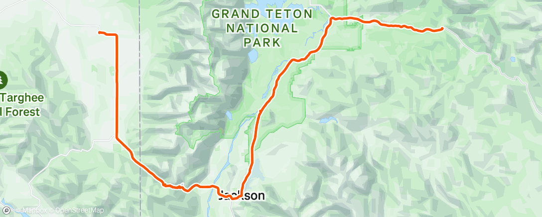
Today was big one. We started in Tetonia Idaho, went south through the Teton valley, through the towns of Drigs and Victor. The next 2 hrs were spent climbing Teton Pass. Long and steep. At the top you cross into Wyoming


The view to the east looks out over Jackson Hole. I took a bikepath down from the summit. It was very steep and twisty. I had to stay on the brakes quite a bit to maintain control. I stopped several times to let my rims cool off. Successfully made it down to the Valley and passed through the town of Wilson. ( reminded me of Tom Hanks companion in Castaway). The route drops right into the middle of Jackson. On the surface it reminded me of Aspen. Extremely crowded both on the sidewalks and the roads. Fortunately there's a good system of bike paths. I headed north on a bike path parallel to Rt 191.
This enters the park boundary of Grand Teton National Park since this a fairly busy transport route,
you don't have to stop at a gate. The bike path ended about half way up to my turn-off, so I was on the shoulder of the road.

This is the valley of the Snake River. The configuration of this valley is the same as I described for the Madison river valley south of Ennis MT. There are stream “benches” on both sides of the river. The Tetons are very prominent to the west.

The northern terminus of Grand Teton National Park is the Moran gate. Moran Junction is just south of the Moran Gate. The route heads east up Togwotee Pass, where we cross the continental divide again.

A herd of bison in the distance as I started the climb of Togwotee Pass.
We are spending the night at Togwotee Mountain Lodge, near the summit. We're at 8200 ft elevation.


Comments
Post a Comment