Over the Continental Divide (for the first time)
Day 12
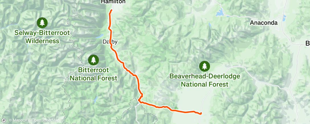
Today, we travelled south from Hamilton MT following the Bitterroot River. Pass through the town of Darby. Both sides of the road sported ranches, some productive, some raising horses, some cattle.
Off to the right (west) the Bitterroot Mountain range fills the skyline. The most prominent peak is Trapper Peak, the tallest peak in the Bitterroots, at about 10,000 ft.

The road enters a narrow canyon, and looses the shoulder, putting bikes on the road. I had to dive for the roadside a couple of times, but no close calls. I stopped in a driveway entrance, and the owner was coming down, heading to town with his horse trailer. I found out that there was a pretty severe fire in the canyon back in 2000. There are still some burned trees standing up on the hillsides. Fortunately the shoulder returned and was present for the rest of the climb.
This peaks out at Lost Trail Pass, then if you stay on route 93, you drop back down to Idaho.
I turned left on MT 43 (and kept climbing) to Joseph pass at about 7200 feet, crossing the continental divide. Then down hill and across a valley to the tiny town of Wisdom (Population 100).


So fun to see where you are. The Continental Divide looks so beautiful. Thankful you got the bike lane/shoulder back before too long. Safe travels ~ God bless you ~ Wyn & Kay
ReplyDelete